Quantcast


Walking and Hiking in Vermont's Northeast Kingdom

The Northeast Kingdom is one of the most remote regions in New England, which means that there is no shortage of trails to explore. Walk and hike through hundreds of miles of beautiful, scenic wilderness. Some trails are maintained by organizations or the state, while others might seem more untouched, so be sure to bring maps with you – stay safe and have fun.
Mount Pisgah Trail - Westmore, VT
Mount Pisgah Trails

Route 5A Westmore, VT, 05860 Phone:

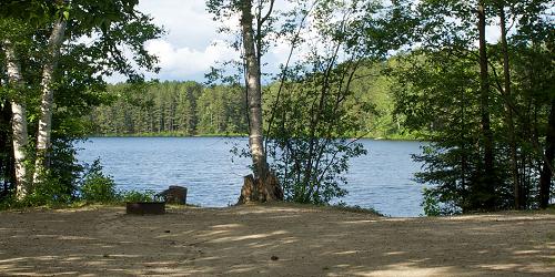
Westmore and Mount Pisgah are a short drive from the town of Burke. You will find great hiking trails here. The summit has two overlooks, one with a view of the Passumpsic Valley and the southern White Mountains, the other of Bald Mountain and the northern White Mountains.
Trailhead and parking: The trailhead and parking for the South Trail are on Route 5A about one-half mile south of the southern end of Willoughby Lake. The climb for the South Trail is 1480 feet. From the summit you can connect to the North Trail of Mount Pisgah.
The trailhead and parking for the North Trail are along Route 5A one mile south of Long Pond Road and about two and one-half miles north of the southern end of Willoughby Lake. The North Trail offers a climb of 1530 feet with a two-mile hike. From the summit you can connect to the South Trail of Mount Pisgah.
The trailhead for the East Trail is in Westmore about 1.8 miles up Long Pond Road. The East Trail offers a climb of 900 feet with a two-mile hike. The trail connects to the Mount Pisgah North and South Trails. - Trail Map & Add'l Info
Brighton State Park - Island Pond, VT - Photo Credit VT State Parks
Brighton State Park Nature Trails

Brighton State Park, 102 State Park Road Island Pond, VT, 05846 Phone: 802-723-4360

Easy loops of 0.25 to 0.50 mile, with guide to natural sights; good for kids

Brighton State Park lies in the heart of Vermont’s Northeast Kingdom, north of the interesting town of St. Johnsbury. This is the wildest and most isolated area in Vermont, rich in legends of Indians and loggers. It is the go-to place for serious outdoor sportsmen. A designated Northeast Kingdom Nature Trail online guide is a great accompaniment for nature lovers. All trails have woodland views and are easy, from 0.25 to 0.50 mile. They are called the Red Pine, Main, Shore trails, and the Loggers Loop. Fun for nature watchers of all ages. - Trail Map (PDF)
Bald Mountain Trails - Orleans, VT
Bald Mountain Trails

Off of VT Route 5A or Mad Brook Road from Westmore or East Charleston, VT Phone:

Two hiking trails can take walkers to the summit of Bald Mountain - Mad Brook Trail and Long Pond Trail. Long Pond Trail begins just east of the Long Pond fishing access on Long Pond Road, two miles east of Vermont Route 5A. The trail has blue blazes and it travels through hardwood forest and crosses some small streams. Trail distance is two miles and the ascent is 1,250 feet. Mad Brook Trail approaches Bald Mountain from the north, beginning at Mad Brook Road in East Charleston. A small parking area is available. The trail follows a gravel road and passes a private dwelling and then enters an open meadow, followed by forest. Trail distances is about three miles with a 1,415-foot ascent. - Trail Map & Add'l Info